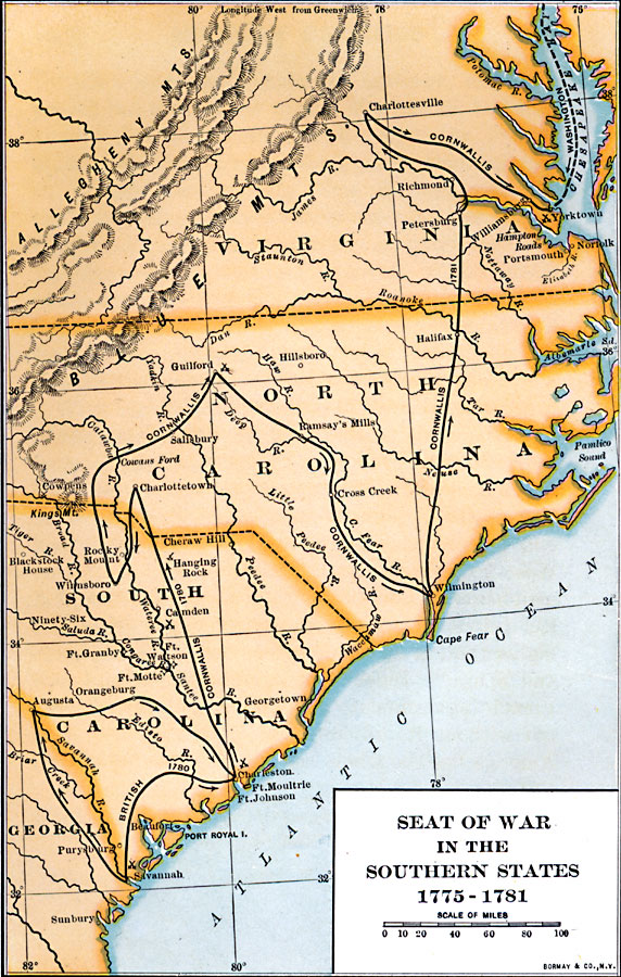
Description: A map of parts of Virginia, North Carolina, South Carolina, and Georgia showing the seat of war in the southern states during the American Revolution. The map shows the routes of Cornwallis from Savannah to Augusta, Charleston, Guilford Court House, Wilmington, Richmond, Charlottesville to Yorktown, and the route of Washington from Philadelphia to Yorktown. The map shows major cities and towns, forts, and battle sites in the southern theater.
Place Names: Early America 1400-1800, Savannah, �Charleston, �Richmond, �American Revolutio
ISO Topic Categories: transportation,
intelligenceMilitary,
location,
inlandWaters,
oceans,
boundaries
Keywords: Seat of War in the Southern States, physical, �political, �transportation, kAmericanRevolution, physical features, major political subdivisions, roads,
water routes, transportation,
intelligenceMilitary,
location,
inlandWaters,
oceans,
boundaries, Unknown, 1775–1781
Source: Albert Bushnell Hart, LL.D., The American Nation Vol 9 (New York, NY: Harper and Brothers, 1906) 290
Map Credit: Courtesy the private collection of Roy Winkelman |
|