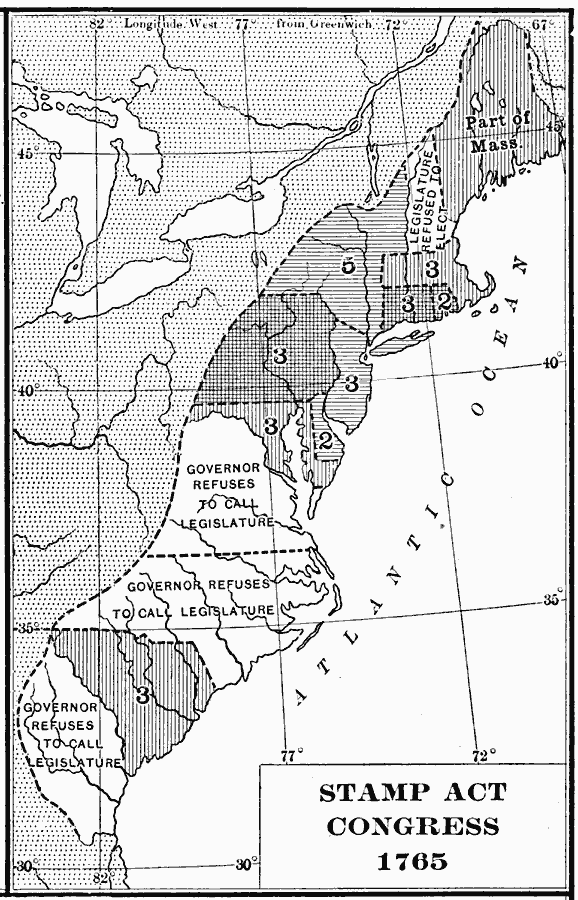
Description: A map of the British Colonies showing the colonies participating in the Stamp Act Congress of 1765 held in Federal Hall, New York City. The map shows the number of delegates from each colony, and the colonies that refused to call legislature (Georgia, New Hampshire, North Carolina, and Virginia).
Place Names: Early America 1400-1800,
ISO Topic Categories: boundaries,
inlandWaters,
location,
oceans
Keywords: Designation of Members to the General Stamp Act Congress, physical, �political, �General Stamp Act Congress, �Stamp Act, physical features, country borders,
major political subdivisions, boundaries,
inlandWaters,
location,
oceans, Unknown, 1765
Source: Albert Bushnell Hart, LL.D., The American Nation Vol 8 (New York, NY: Harper and Brothers, 1906) 154
Map Credit: Courtesy the private collection of Roy Winkelman |
|