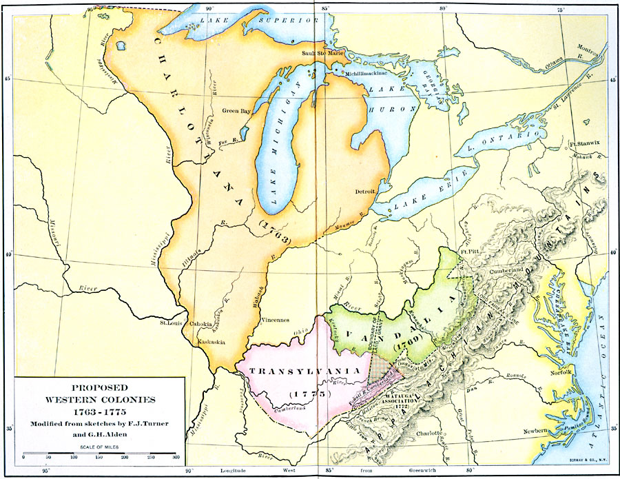
Description: A map of the territory east of the Mississippi River and west of the Allegheny Mountains showing the proposed western colonies from 1763—1775. The map shows the proposed colony of Charlotiana (1763) between the Mississippi River to the west and the Wabash and Miami rivers to the east, Transylvania south of the Ohio River, and Vandalia to the east between the Ohio River and the Allegheny Mountains.
Place Names: Early America 1400-1800, Green Bay, �Detroit, �Norfolk, �Colonial Americ
ISO Topic Categories: boundaries,
inlandWaters,
location
Keywords: Proposed Western Colonies, physical, �political, physical features, major political subdivisions, boundaries,
inlandWaters,
location, Unknown, 1763–1775
Source: Albert Bushnell Hart, LL.D., The American Nation Vol 8 (New York, NY: Harper and Brothers, 1906) 230
Map Credit: Courtesy the private collection of Roy Winkelman |
|