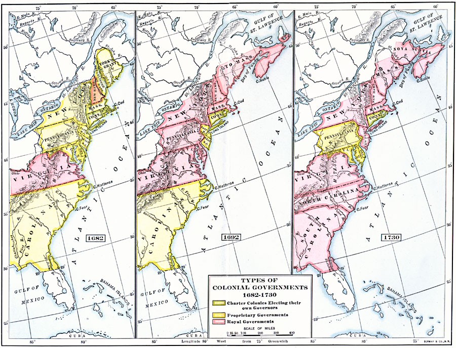
Description: A series of three maps of the British colonies in North America showing the types of colonial governments between 1682, 1692, and 1730, and the shift from charter colonies electing their own governors to the colonies with councilors appointed by the crown. The map is color–coded to show the charter colonies electing their own governors, colonies with proprietary governments, and colonies with royal governments during this period.
Place Names: Early America 1400-1800, Colonial Americ
ISO Topic Categories: boundaries,
inlandWaters,
location,
oceans
Keywords: Types of Colonial Governments, physical, �political, physical features, major political subdivisions, boundaries,
inlandWaters,
location,
oceans, Unknown, 1682–1730
Source: Albert Bushnell Hart, LL.D., The American Nation Vol 6 (New York, NY: Harper and Brothers, 1906) 66
Map Credit: Courtesy the private collection of Roy Winkelman |
|