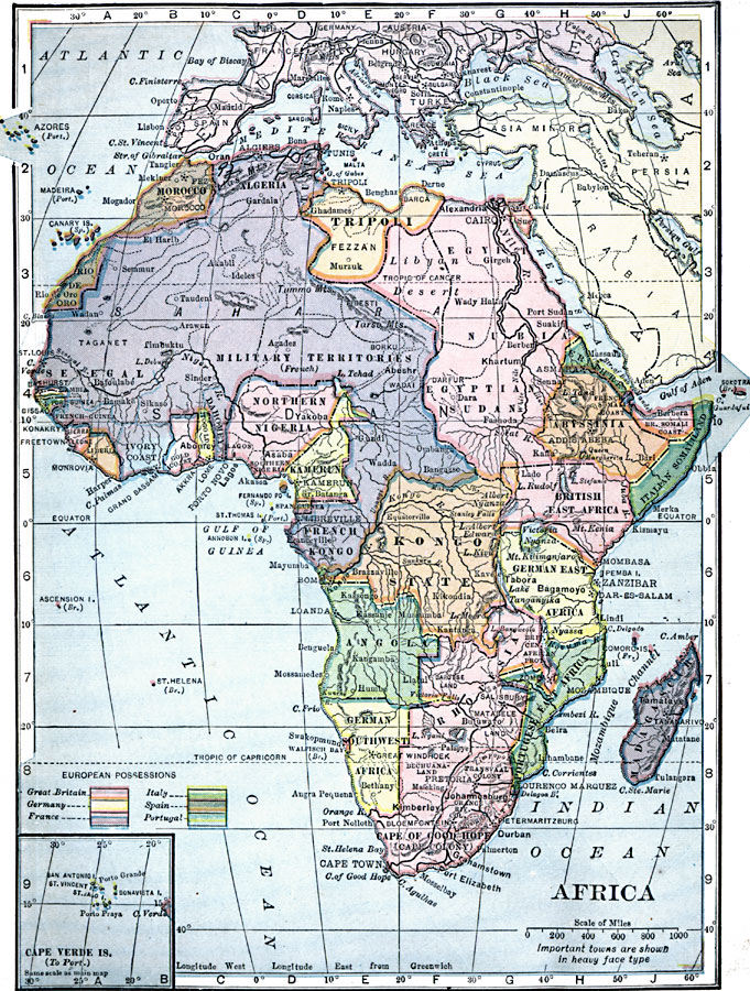
Description: A map of Africa in 1909 showing the European land claims established by the Berlin Conference of 1885. British, German, French, Spanish, and Portuguese possessions are shown, as well as major cities and towns, railroad and trade routes, and major rivers and mountains. An inset map shows the Portuguese controlled Cape Verde Islands.
Place Names: A Complete Map of Africa, Cape Verde Islands, Rhodesia, German Southwest Africa, Portuguese East Africa, Angola, Madagascar, French Kongo, Kongo State, German East Africa, British East Africa, Kamerun, Northern Nigeria, Italian Somaliland, British Somali Coast, Abyssinia, Erythrea, Egyptian Sudan, Nubia, Egypt, Tripoli, Dahomey, French Military Territories, Togo Land, Gold Coast, Ivory Coast, Liberia, Sierra Leon, French Guinea, Bissao, Nambia, Senegal, Rio de Oro, Canary Islands, Morocco, Algeria
ISO Topic Categories: oceans,
location,
inlandWaters
Keywords: Africa: European Possessions, local jurisdictions, �political, kBerlinConference, local jurisdictions, oceans,
location,
inlandWaters, Unknown, 1909
Source: C. S. Hammond, Hammond's Handy Atlas of the World (New York, New York: C. S. Hammond & Company, 1911) 75
Map Credit: Courtesy the private collection of Roy Winkelman |
|