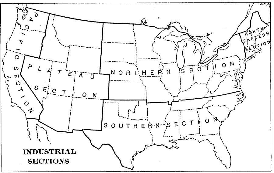
Description: A map from 1901 of the United States showing the product regions by separating the country into "(1) the Northeastern, or cloth–manufacturing section; (2) the Northern, or food–, iron–, and coal–producing, and manufacturing section; (4) the Plateau, or grazing and gold– and silver–mining section; and (5) the Pacific, or Western food– and gold–producing section." — Natural Advanced Geography, 1901.
Place Names: Industry,
ISO Topic Categories: farming,
boundaries,
economy,
inlandWaters,
oceans
Keywords: United States Industrial Sections, physical, �political, �statistical, kIndustry, physical features, major political subdivisions,
country borders, industry, farming,
boundaries,
economy,
inlandWaters,
oceans, Unknown, 1901
Source: Jacques W. Redway, Natural Advanced Geography (New York, NY: American Book Company, 1901) 61
Map Credit: Courtesy the private collection of Roy Winkelman |
|