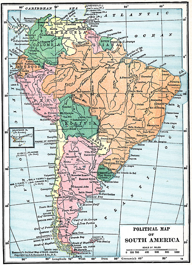
Description: A map of South America from 1919 showing the political boundaries of the time. The map shows capitals, major cities, ports, rivers, and coastal features. An inset map shows the Galapagos Islands.
Place Names: A Complete Map of South America, Venezuela, �Ecuador, �Columbia, �Brazil, �Chile, �Uraguay, �Peru, �Bolivia, �Paraguay, �Argentina, �Guiana, �Galapago
ISO Topic Categories: boundaries,
inlandWaters,
location,
oceans
Keywords: South America, physical, �political, physical features, country borders, boundaries,
inlandWaters,
location,
oceans, Unknown, 1919
Source: Charles Morris, Winston's Cumulative Encyclopedia Vol 9 (Philadelphia, PA: The John C. Winston Company, 1919) tab 7
Map Credit: Courtesy the private collection of Roy Winkelman |
|