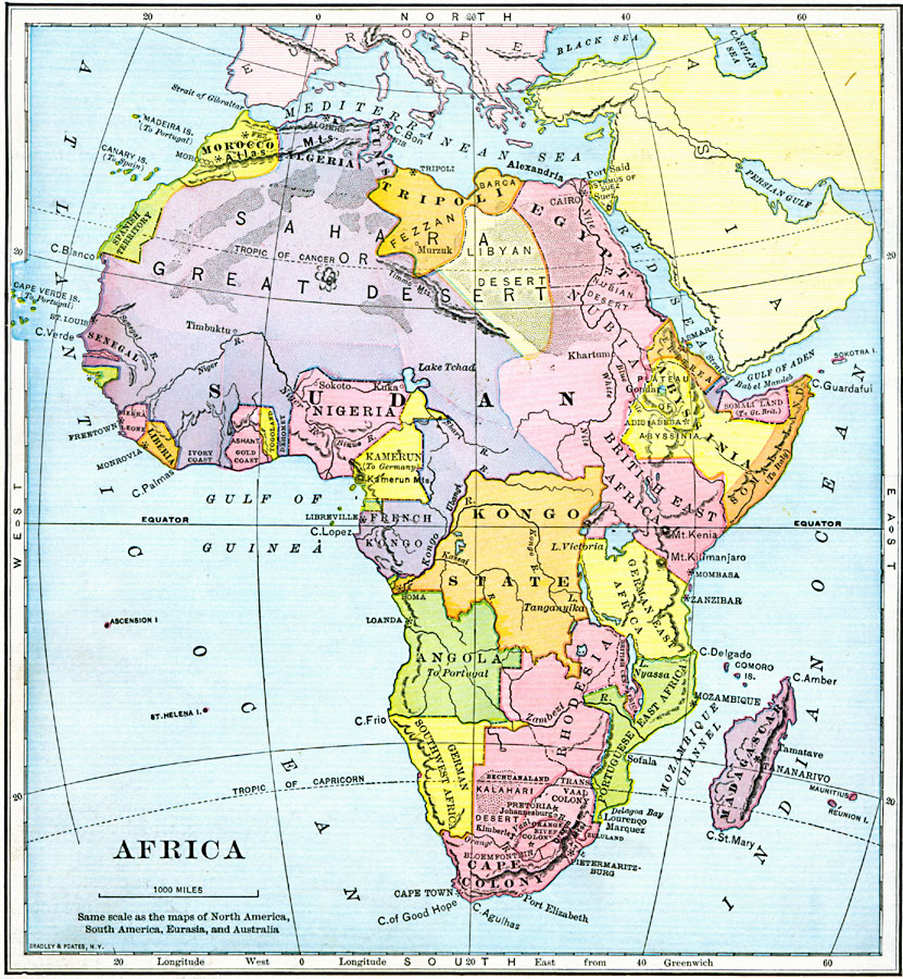
Description: Map of Africa in 1897 showing the European land claims established by the Berlin Conference of 1885. This map also shows major cities and towns, mountain regions, deserts, and river systems.
Place Names: A Complete Map of Africa, Algeria, �Congo, �Egypt, �Ethiopia, �Lybia, �Madagascar, �Nigeria, �Somalia, �South Africa, �Sudan, Spanish Territory, Morocco, Algeria, Tripoli, Tunis, Fezzan, Isthmus of Suez, Eretrea, Abyssinia, British Somaliland, Italian Somaliland, British East Africa, Kamerun, Dahomey, Togoland, Gold Coast, Ivory Coast, Liberia, Sierra Leon, Senegal, French Kongo, Kongo State, German East Africa, German Southwest Africa, Angola, Rhodesia, Portuguese East Africa, Cape Colony
ISO Topic Categories: location,
oceans,
inlandWaters
Keywords: Colonial Africa, country borders, �physical, �topographical, �political, kBerlinConference, physical features,
topographical, country borders, location,
oceans,
inlandWaters, Unknown, 1897
Source: Jacques W. Redway & Russell Hinman, Natural Introductory Geography (New York, NY: American Book Company, 1897) 130
Map Credit: Courtesy the private collection of Roy Winkelman |
|