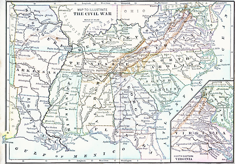
Description: A map of the southeastern part of the United States showing important sites of the Civil War (1861–1865). The map shows major cities, railroads, rivers, and terrain of the region. An inset map shows northeastern Virginia, with forts and battle sites.
Place Names: Civil War, Alabama, �Arkansas, �Florida, �Georgia, �Kentucky, �Maryland, �Mississippi, �Missouri, �North Carolina, �South Carolina, �Tennessee, �Virginia, �West Virgini
ISO Topic Categories: oceans,
location,
inlandWaters
Keywords: The Civil War, Civil War, �colonies, �historical, �military,other military,
historical event,
Civil War, oceans,
location,
inlandWaters, Unknown, 1861–1865
Source: A. S. Barnes, A Brief History of the United States (New York, NY: American Book Company, 1885)
Map Credit: Courtesy the private collection of Roy Winkelman |
|