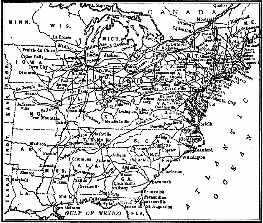
Description: Transportation between the east and west after the building of the trunk lines
Place Names: Transportation, Alabama, �Arkansas, �Delaware, �Florida, �Georgia, �Illinois, �Indiana, �Iowa, �Kentucky, �Maine, �Maryland, �Michigan, �Mississippi, �Missouri, �New Jersey, �New York, �North Carolina, �Ohio, �Pennsylvania, �South Carolina, �Tennessee, �Unit
ISO Topic Categories: oceans,
location,
inlandWaters,
boundaries,
transportation
Keywords: Transportation After Building the Trunk Lines, borders, �historical, �physical, �railroads, �transportation, kTransportation, physical features, railroads, historical event, oceans,
location,
inlandWaters,
boundaries,
transportation, Unknown, 1850
Source: S.E. Forman, Advanced American History (New York, NY: The Century Company, 1919) 410
Map Credit: Courtesy the private collection of Roy Winkelman |
|