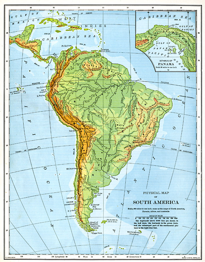
Description: A map from 1901 of South America showing the general physical features including mountain systems, prominent peaks and volcanoes, river and lake systems, plateaus, and coastal features. The map is color–coded with the highlands above 2000 feet shown in buff tints, the lowlands in green tints, and the submerged part of the continental plateau in the light blue tint. The area coverage includes the West Indies and Caribbean Sea in the north to Tierra del Fuego in the south. The main geophysical features shown are the Andes mountain chain, Llanos, Plateau of Guiana, Silvas, Plateau of Bolivia, Plateau of Brazil, and the Pampas. An inset map details the Isthmus of Panama.
Place Names: A Complete Map of South America, Plateau of Guiana, �Plateau of Brazil, �Plateau of Bolivia, �Pampas, �Andes Mountain
ISO Topic Categories: inlandWaters,
oceans
Keywords: Physical Map of South America, physical, physical features,
topographical, inlandWaters,
oceans, Unknown, 1901
Source: Jacques W. Redway, Natural Advanced Geography (New York, New York: American Book Company, 1901) 102
Map Credit: Courtesy the private collection of Roy Winkelman |
|