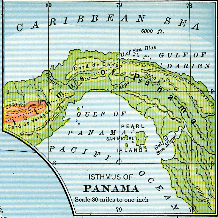
Description: A map from 1901 of the Isthmus of Panama, showing the terrain and coastal features. The map uses color–contouring to show general elevations, with dark green areas from sea level to 1,000 feet, light green areas from 1,000 to 2,000 feet, and brown areas above 2,000 feet. The continental divide is indicated by the dotted line.
Place Names: Panama, Gulf of Darien, �Isthmus of Panama, �Cord de Chepo, �Gulf of San Miguel, �San Miguel, �Pearl Islands, �Panam
ISO Topic Categories: inlandWaters,
oceans,
location
Keywords: Isthmus of Panama, physical, physical features,
topographical, inlandWaters,
oceans,
location, Unknown, 1901
Source: Jacques W. Redway, Natural Advanced Geography (New York, NY: American Book Company, 1901) 102
Map Credit: Courtesy the private collection of Roy Winkelman |
|