Maps Site map
  Maps > North America > Panama
Site Map  

  Record   1   to   3  of   3

Historic and contemporary maps of the Isthmus of Panama for use in the K-12 classroom.
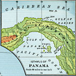
Isthmus of Panama, 1901
A map from 1901 of the Isthmus of Panama, showing the terrain and coastal features. The map uses color–contouring to show general elevations, with dark green areas from sea level to 1,000 feet, light green areas from 1,000 to 2,000 feet, and br...

Panama, 1906
A map from 1906 of the Isthmus of Panama showing the railroad from Colon to the city of Panama, the projected route of the canal, the provinces of Panama at the time (Chiriqui, Veraguas, Azuero, and Panama), and the borders with Costa Rica to the nor...

Panama Canal, 1911
A map from 1911 of the Panama Canal, showing the line of the canal with the miles from Colon given (49 miles from Colon to Panama City), the existing and proposed location of the Panama Railroad, dams, feeding rivers and mountains, towns and roads, a...


  Maps > North America > Panama
Site Map  

Maps ETC is a part of the Educational Technology Clearinghouse
Produced by the Florida Center for Instructional Technology © 2009
College of Education, University of South Florida