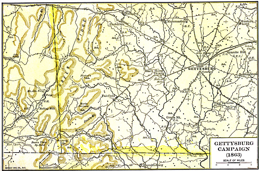
Description: A detailed map of the area of the Gettysburg Campaign in 1863 during the American Civil War. The map shows Gettysburg and surrounding towns (individual buildings in the country can be seen), roads and railways, terrain features, and rivers of the area.
Place Names: Civil War, Gettysburg, �Hilltow
ISO Topic Categories: location,
inlandWaters,
transportation,
intelligenceMilitary
Keywords: Gettysburg Campaign, physical, �political, �transportation, �historical, physical features, local jurisdictions,
major political subdivisions, roads,
railroads, Civil War, location,
inlandWaters,
transportation,
intelligenceMilitary, Unknown, 1863
Source: Albert Bushnell Hart, LL.D., The American Nation Vol. 20 (New York, NY: Harper and Brothers, 1907) 288
Map Credit: Courtesy the private collection of Roy Winkelman |
|