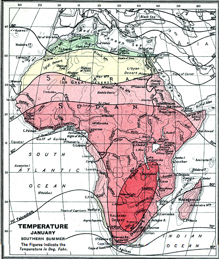
Description: A map from 1915 of Africa and Madagascar showing mean temperatures throughout the region in January, given in degrees Fahrenheit. The map is color–coded to show the temperate temperatures below 70° in greens and yellow, and warm temperatures above 70° in reds.
Place Names: A Complete Map of Africa, Algeria, �Congo, �Egypt, �Lybia, �Madagascar, �Nigeria, �Somalia, �South Africa, �Sudan,
ISO Topic Categories: inlandWaters,
oceans,
location,
boundaries,
climatologyMeteorologyAtmosphere
Keywords: Temperature in Africa in January, physical, �political, �borders, �boundaries,�meteorological, �climate, �temperature, physical features,
topographical, country borders, climate,
temperature, inlandWaters,
oceans,
location,
boundaries,
climatologyMeteorologyAtmosphere, Unknown, 1915
Source: J.G. Bartholomew, A School Economic Atlas (London, England: Oxford University Press, 1915) 36
Map Credit: Courtesy the private collection of Roy Winkelman |
|