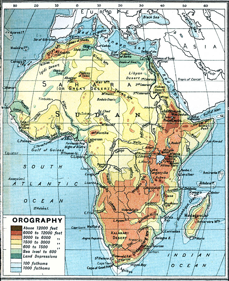
Description: A map from 1915 of Africa and Madagascar showing general land elevations above and below sea level, and landform features, including mountain systems, plateaus, deserts, and plains throughout the region. The map uses color–contouring to show land depressions and elevations from below sea level to above 12000 feet, and water depths at the 100 and 1000 fathom lines.
Place Names: A Complete Map of Africa, Algeria, �Congo, �Egypt, �Lybia, �Madagascar, �Nigeria, �Somalia, �South Africa, �Suda
ISO Topic Categories: inlandWaters,
oceans,
location,
boundaries,
elevation
Keywords: Africa – Orographical, physical, �topographical, �political, �borders, �boundaries, �elevation, �physical features,
topographical, country borders, inlandWaters,
oceans,
location,
boundaries,
elevation, Unknown, 1915
Source: J.G. Bartholomew, A School Economic Atlas (London, England: Oxford University Press, 1915) 37
Map Credit: Courtesy the private collection of Roy Winkelman |
|