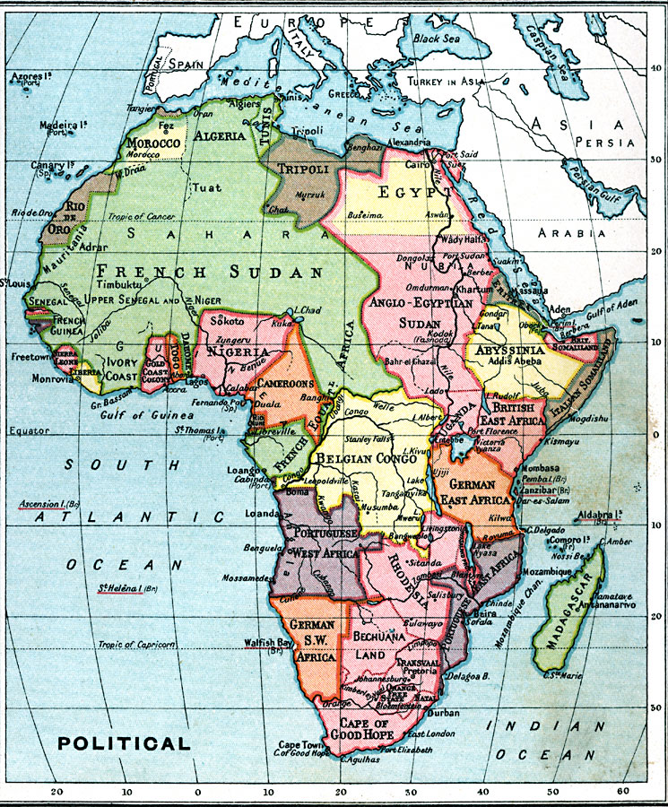
Description: A map from 1915 of Africa and Madagascar showing the political boundaries and principal cities throughout the region at the time, including European possessions.
Place Names: A Complete Map of Africa, Algeria, �Congo, �Egypt, �Lybia, �Madagascar, �Nigeria, �Somalia, �South Africa, �Suda
ISO Topic Categories: inlandWaters,
oceans,
location,
boundaries,
society
Keywords: Political Map of Africa, physical, �political, �borders, �boundaries, �subdivisions, physical features, country borders,
major political subdivisions, inlandWaters,
oceans,
location,
boundaries,
society, Unknown, 1915
Source: J.G. Bartholomew, A School Economic Atlas (London, England: Oxford University Press, 1915) 37
Map Credit: Courtesy the private collection of Roy Winkelman |
|