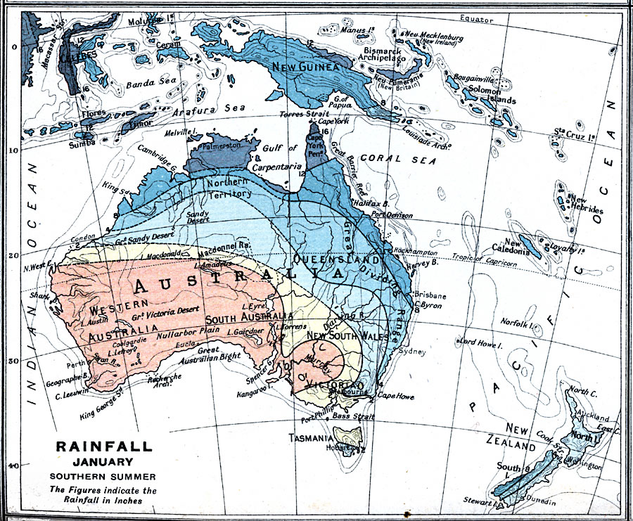
Description: A map from 1915 of Australia showing mean rainfall distribution throughout the region in January, given in inches of precipitation. The map is color–coded to show the areas of sparse, moderate, and heavy rainfall.
Place Names: A Complete Map of Australia, Brisbane, �Melbourne, �Perth, �Sydne
ISO Topic Categories: inlandWaters,
oceans,
location,
society,
climatologyMeteorologyAtmosphere,
boundaries
Keywords: Rainfall in Australia in January, physical, �political, �borders, �meteorological, �rainfall, physical features, country borders, rainfall, inlandWaters,
oceans,
location,
society,
climatologyMeteorologyAtmosphere,
boundaries, Unknown, 1915
Source: J.G. Bartholomew, A School Economic Atlas (London, England: Oxford University Press, 1915) 48
Map Credit: Courtesy the private collection of Roy Winkelman |
|