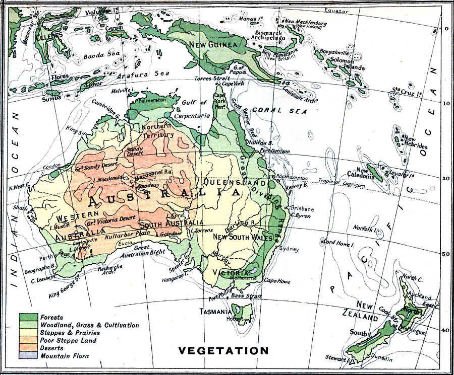
Description: A map from 1915 of Australia showing the general vegetation regions. The map is color–coded to show areas of forests, grasslands, steppes, poor steppes, deserts, and mountain flora.
Place Names: A Complete Map of Australia, Brisbane, �Melbourne, �Perth, �Sydne
ISO Topic Categories: inlandWaters,
oceans,
location,
boundaries,
biota
Keywords: Vegetation Map of Australia, physical, �topographical, �political, �borders, �statistical, �vegetation, �biota, �physical features,
topographical, country borders, vegetation, inlandWaters,
oceans,
location,
boundaries,
biota, Unknown, 1915
Source: J.G. Bartholomew, A School Economic Atlas (London, England: Oxford University Press, 1915) 49
Map Credit: Courtesy the private collection of Roy Winkelman |
|