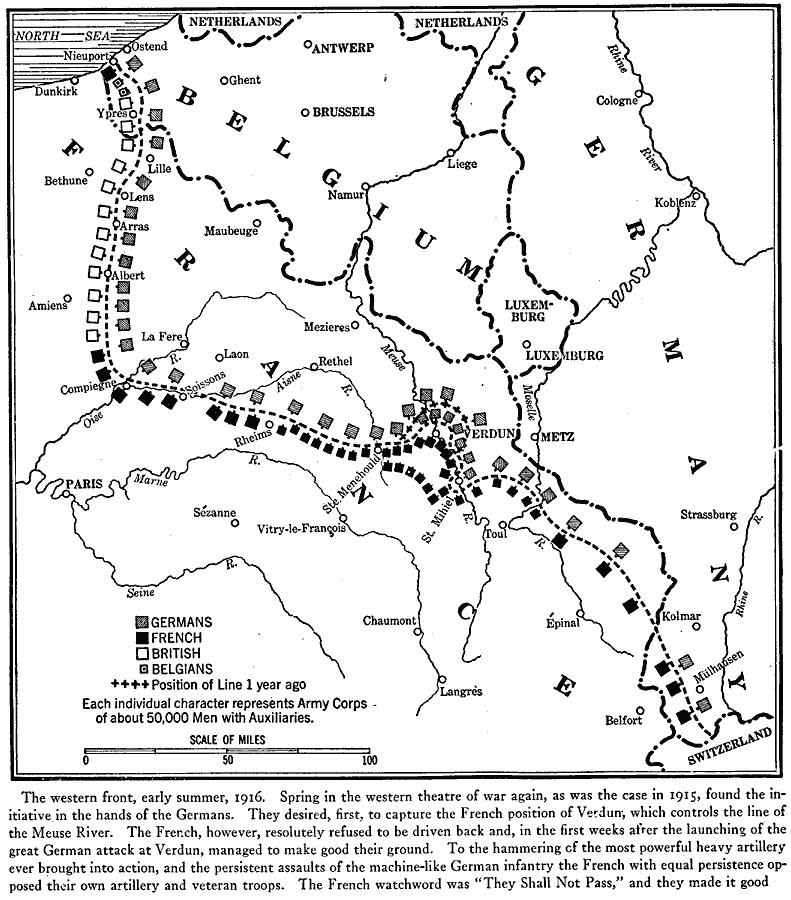
Description: A map of portions of France, Germany, Belgium, and Luxemburg in the early summer of 1916 showing the battle line and troop positions at the time of the German offensive toward Paris. The map shows the battle line of 1915 near Verdun, and the position of German, French, British, and Belgian troops along the line. The map notation details prominent events of the offensive.
Place Names: Western Europe, Belgium, �France, �Germany, �Netherlands, �United Kingdom, �Verdu
ISO Topic Categories: location,
inlandWaters,
oceans,
boundaries
Keywords: World War I Troop Positions on the Western Front, borders, �historical, �physical, �World War I, kWWI, country borders, WWI, location,
inlandWaters,
oceans,
boundaries, Unknown, 1916
Source: Willis J. Abbot, Pictorial History of the World War (New York, NY: Leslie-Judge Company, 1919) 59
Map Credit: Courtesy the private collection of Roy Winkelman |
|