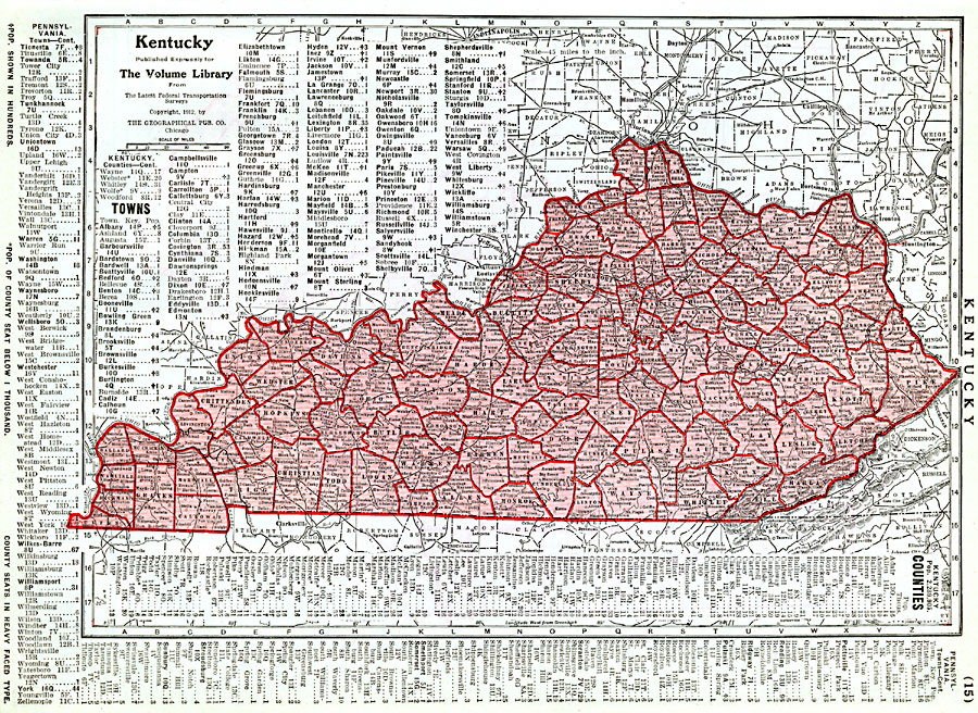
Description: A map from 1912 of Kentucky showing the State capital of Frankfort, counties and county seats, major cities and towns, railroads, and rivers. A grid reference in the margins of the map lists counties with populations given in thousands and principal cities and towns with populations given in hundreds.
Place Names: Kentucky, Frankfort, �Burkesville, �Danville, �Grayson, �Lexington, �Louisville, �Shelbyvill
ISO Topic Categories: transportation,
location,
inlandWaters,
boundaries
Keywords: Kentucky, physical, �political, �transportation, physical features, major political subdivisions,
county borders, railroads, transportation,
location,
inlandWaters,
boundaries, Unknown, 1912
Source: Henry W. Ruoff, The Volume Library (Chicago, IL: The W. E. Richardson Company, 1912) 15
Map Credit: Courtesy the private collection of Roy Winkelman |
|