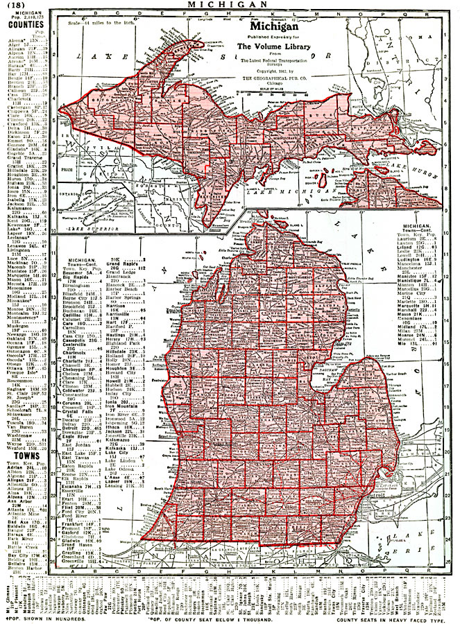
Description: A map from 1912 of Michigan showing the capital city of Lansing, counties and county seats, major cities and towns, railroads, rivers, and lake shoreline. The inset map covers the Upper Peninsula. A grid reference in the margins of the map lists counties with populations given in thousands and principal cities and towns with populations given in hundreds.
Place Names: Michigan, Battle Creek, �Kalamazoo, �Grand Rapids, �Detroit, �Lansing, �East Saginaw, �Flint, �Jackson, �Niles, �Pontia
ISO Topic Categories: transportation,
boundaries,
inlandWaters,
location
Keywords: Michigan, physical, �political, �transportation, physical features, major political subdivisions,
county borders, railroads, transportation,
boundaries,
inlandWaters,
location, Unknown, 1912
Source: Henry W. Ruoff, The Volume Library (Chicago, IL: The W. E. Richardson Company, 1912) 18
Map Credit: Courtesy the private collection of Roy Winkelman |
|