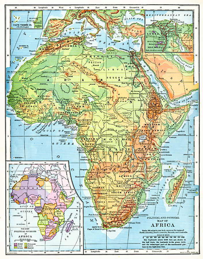
Description: A map from 1901 of the political and physical features of Africa. The map uses color–contouring to show highlands above 2000 feet in buff tints, lowlands in greens, and the submerged part of the continental plateau in light blue. The map shows country borders and capitals, principal cities, towns, and ports, railroads, mountain and river systems, watershed division lines, lakes, deserts, and coastal features. A smaller political map shows the European possessions in Africa, and is color–coded to show the claims of the British, French, Germans, Portuguese, Italians, and Spanish. Inset maps detail the Cape Verde Islands and the Nile Delta.
Place Names: A Complete Map of Africa, Cape Verde Islands, �Morocco, �Algeria, �Tunis, �Tripoli, �Egypt, �Alexandria, �West Africa, �Northern Nigeria, �Kamerun, �Eritrea, �Abyssinia, �Somaliland, �Highland, �Kongo State, �African Highlands, �Rhodesia, �German Southwest Africa, �Cape Colony,
ISO Topic Categories: boundaries,
inlandWaters,
location,
oceans
Keywords: Political and Physical Africa, physical, �political, physical features, country borders, boundaries,
inlandWaters,
location,
oceans, Unknown, 1901
Source: Jacques W. Redway, Natural Advanced Geography (New York, NY: American Book Company, 1901) 144
Map Credit: Courtesy the private collection of Roy Winkelman |
|