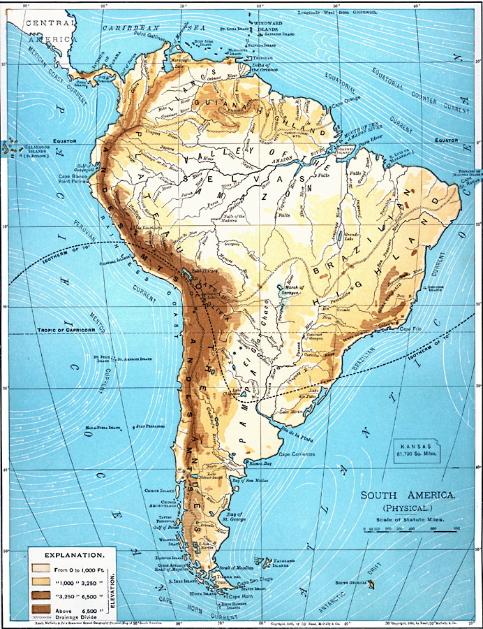
Description: A map from 1901 of South America showing the physical features of the region. This map is color–coded to show general elevations from sea level to over 6,500 feet, mountain systems, drainage divides, lakes, rivers, coastal features, and the major ocean currents with direction of flow given. The temperate isotherm of mean annual 70° is shown. This map shows the Caribbean Sea, Atlantic, and Pacific, coastal features, volcanoes, prominent peaks, and major rivers, as well as the physiographic regions of Andes Mountains, Llanos, Guiana Highlands, Selvas and Valley of the Amazon, Brazilian Highlands, Plateau of Bolivia, El Gran Chaco, Pampas, and the Plateau of Patagonia. An outline map of Kansas is included at the same map scale to show the comparative area size relationship.
Place Names: A Complete Map of South America, Argentina, �Bolivia, �Brazil, �Chile, �Columbia, �Ecuador, �Paraguay, �Peru, �Uraguay, �Venezuel
ISO Topic Categories: oceans,
location,
inlandWaters
Keywords: South America (Physical), borders, �physical, �topographical, kComparativeArea, topographical, country borders, oceans,
location,
inlandWaters, Unknown, 1901
Source: James A. Bowen, Grammar School Geography (Chicago, IL: Rand, McNally & Company, 1901) 148
Map Credit: Courtesy the private collection of Roy Winkelman |
|