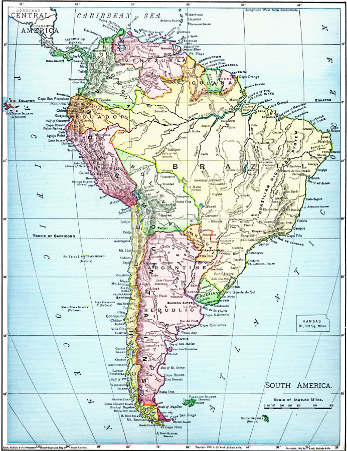
Description: A map from 1901 of South America showing the political boundaries at the time, including Columbia (extending to Costa Rica), Venezuela, Guiana (British, Dutch, and French), Ecuador, Peru, Brazil, Bolivia, Chile, Argentine Republic, and Uruguay. Major cities, ports, railroads, rivers, lakes, mountain systems, and terrain coastal features are shown. An outline map of Kansas is included at the same map scale to show the comparative area size relationship.
Place Names: A Complete Map of South America, Argentina, �Bolivia, �Brazil, �Chile, �Columbia, �Ecuador, �Paraguay, �Peru, �Uraguay, �Venezuel
ISO Topic Categories: oceans,
location,
inlandWaters
Keywords: South America, borders, �physical, kComparativeArea, country borders, oceans,
location,
inlandWaters, Unknown, 1901
Source: James A. Bowen, Grammar School Geography (Chicago, IL: Rand, McNally & Company, 1901) 151
Map Credit: Courtesy the private collection of Roy Winkelman |
|