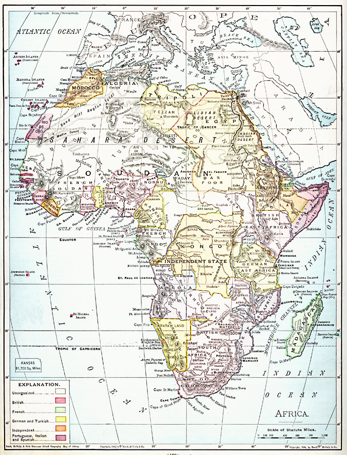
Description: A map from 1901 of Africa showing political boundaries and capitals, principal cities and towns, mountain systems, rivers, lakes, and coastal features. The map is color–coded to show the European possessions of the British, French, Germans, Turks, Portuguese, Italians, Spanish, and independent territories. The unorganized territories are indicated, and an outline map of Kansas at the same map scale is given to show relative area size.
Place Names: A Complete Map of Africa, Algeria, �Congo, �Egypt, �Ethiopia, �Lybia, �Madagascar, �Nigeria, �Somalia, �South Africa, �Suda
ISO Topic Categories: oceans,
location,
inlandWaters
Keywords: Africa, borders, �ethnological, �physical, �statistical, country borders, oceans,
location,
inlandWaters, Unknown, 1901
Source: James A. Bowen, Grammar School Geography (Chicago, IL: Rand, McNally & Company, 1901) 192
Map Credit: Courtesy the private collection of Roy Winkelman |
|