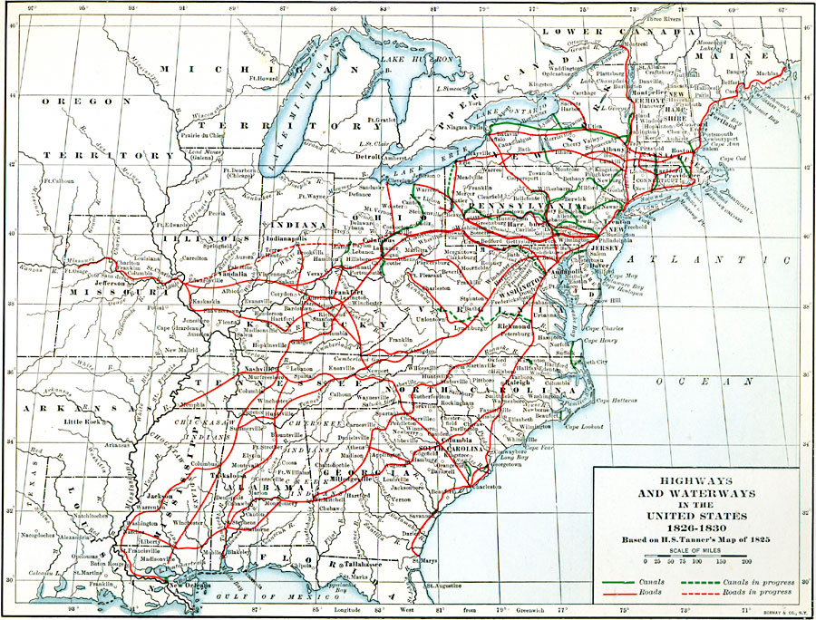
Description: Highways and waterways in the United States in 1826—1830, based on H.S. Tanner's Map of 1825.
Place Names: Transportation, Alabama, �Arkansas, �Connecticut, �Delaware, �Florida, �Georgia, �Indiana, �Kentucky, �Maine, �Maryland, �New Hampshire, �New Jersey, �North Carolina, �Pennsylvania, �South Carolina, �Tennessee, �Vermont, �Virgini
ISO Topic Categories: oceans,
location,
inlandWaters,
transportation
Keywords: Highways and Waterways in the United States, highways, �roads, �transportation, �water routes, kTransportation, roads,
water routes, oceans,
location,
inlandWaters,
transportation, Unknown, 1826–1830
Source: Dixon Ryan Fox, Harper's Atlas of American History (New York, NY: Harper & Brothers Publishers , 1920) 34
Map Credit: Courtesy the private collection of Roy Winkelman |
|