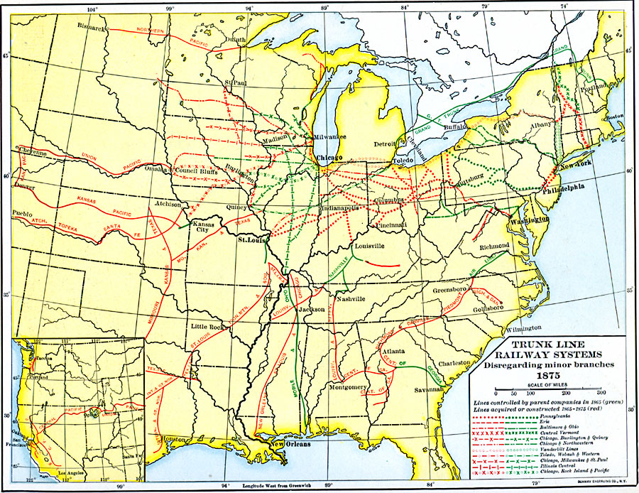
Description: Trunk line railway systems, disregarding minor branches 1875.
Place Names: Transportation, Alabama, �Arkansas, �Connecticut, �Delaware, �Florida, �Georgia, �Indiana, �Kentucky, �Maine, �Maryland, �Massachusetts, �Michigan, �Mississippi, �Missouri, �New Jersey, �New York, �North Carolina, �Ohio, �Pennsylvania, �Rhode Island, �South Carolin
ISO Topic Categories: oceans,
location,
inlandWaters,
transportation
Keywords: Trunk Line Railway Systems, railroads, �transportation, railroads, oceans,
location,
inlandWaters,
transportation, Unknown, 1865–1875
Source: Dixon Ryan Fox, Harper's Atlas of American History (New York, NY: Harper & Brothers Publishers , 1920) 62
Map Credit: Courtesy the private collection of Roy Winkelman |
|