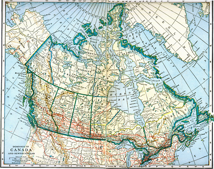
Description: A map from 1921 of the Dominion of Canada and Newfoundland (Newfoundland and Labrador did not become a province of Canada until 1949). The map shows the province capitals and boundaries at the time, major cities and towns, existing and proposed railways, terrain and coastal features, rivers, and lakes of the region.
Place Names: Canada, Calgary, �Churchill, �Edmonton, �Montreal, �Ottawa, �Quebec, �Toronto, �Vancouver, �Victoria, �Winnipe
ISO Topic Categories: oceans,
location,
inlandWaters
Keywords: The Dominion of Canada and Newfoundland, borders, �canals, �physical, �railroads, �transportation, �water routes, country borders, railroads,
water routes, oceans,
location,
inlandWaters, Unknown, 1921
Source: L.L. Poates, Poates Complete Atlas of the World (New York, NY: Poates Corporation , 1921) 8-9
Map Credit: Courtesy the private collection of Roy Winkelman |
|