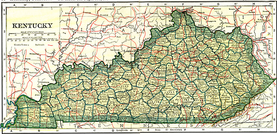
Description: A map from 1919 of Kentucky showing the State capital of Frankfort, counties and county seats, major cities and towns, railroads, and rivers.
Place Names: Kentucky, Burkesville, �Danville, �Frankfort, �Grayson, �Lexington, �Louisa, �Louisville, �Madisonville, �Shelbyville, �Versaille
ISO Topic Categories: oceans,
location,
inlandWaters,
transportation
Keywords: Kentucky, borders, �physical, �railroads, �transportation, �country borders,
county borders, railroads, oceans,
location,
inlandWaters,
transportation, Unknown, 1919
Source: L.L. Poates, Poates Complete Atlas of the World (New York, NY: Poates Corporation , 1921) 58-59
Map Credit: Courtesy the private collection of Roy Winkelman |
|