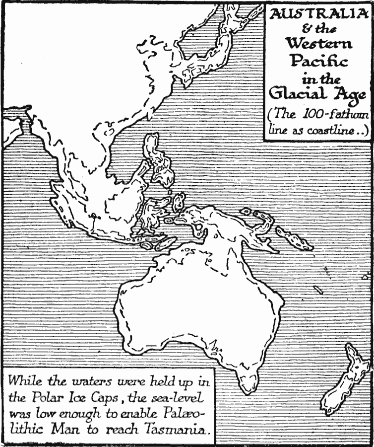
Description: A map showing Australia and the Western Pacific in the Glacial Age (the Maximum of the Fourth Ice Age, about 50,000 years ago — Wells). While the waters were held up in the polar ice caps, the sea–level was low enough to enable Paleolithic people to reach Tasmania. The map shows the 100–fathom line as the suggested coast line during this period.
Place Names: A Complete Map of Australia, Australia, �Asi
ISO Topic Categories: location,
oceans,
boundaries
Keywords: Australia and the West Pacific in the Ice Age, physical, physical features, location,
oceans,
boundaries, Unknown, 20,000 to10,000 BC
Source: H. G. Wells, The Outline of History (New York, NY: The Macmillan Company, 1921) 62
Map Credit: Courtesy the private collection of Roy Winkelman |
|