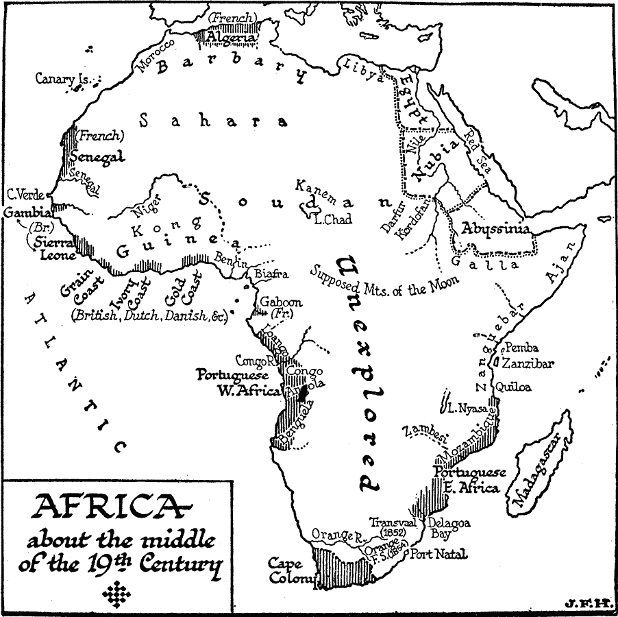
Description: A map of Africa around the middle of the nineteenth century showing European interests on the continent prior to the Berlin Conference of 1885, which established their territorial claims. The majority of the continent was unexplored at this time, and the only country borders shown on this map are for Egypt, Nubia, and Abyssinia. The primary areas of European interest include the French in Algeria and Senegal, the British in Gambia and Sierra Leon, the British, Dutch, Danish and others along the Guinea Coast, the Cape Colony, and the Portuguese along the southern West and East coasts. Major rivers known at the time are shown, as well as the supposed Mountains of the Moon in central Africa.
Place Names: A Complete Map of Africa, Algeria, Barbary, Egypt, Nubia, Abyssinia, Darfur, Lake Chad, Soudan, Lybia, Morocco, Senegal, Gambia, Guinea, Cape Colony, Madagascar
ISO Topic Categories: boundaries,
location,
oceans,
inlandWaters
Keywords: Sketch Map of Mid-Century Africa, physical, �political, kBerlinConference, physical features, major political subdivisions, boundaries,
location,
oceans,
inlandWaters, Unknown, Circa 1850
Source: H. G. Wells, The Outline of History (New York, NY: The Macmillan Company, 1921) 985
Map Credit: Courtesy the private collection of Roy Winkelman |
|