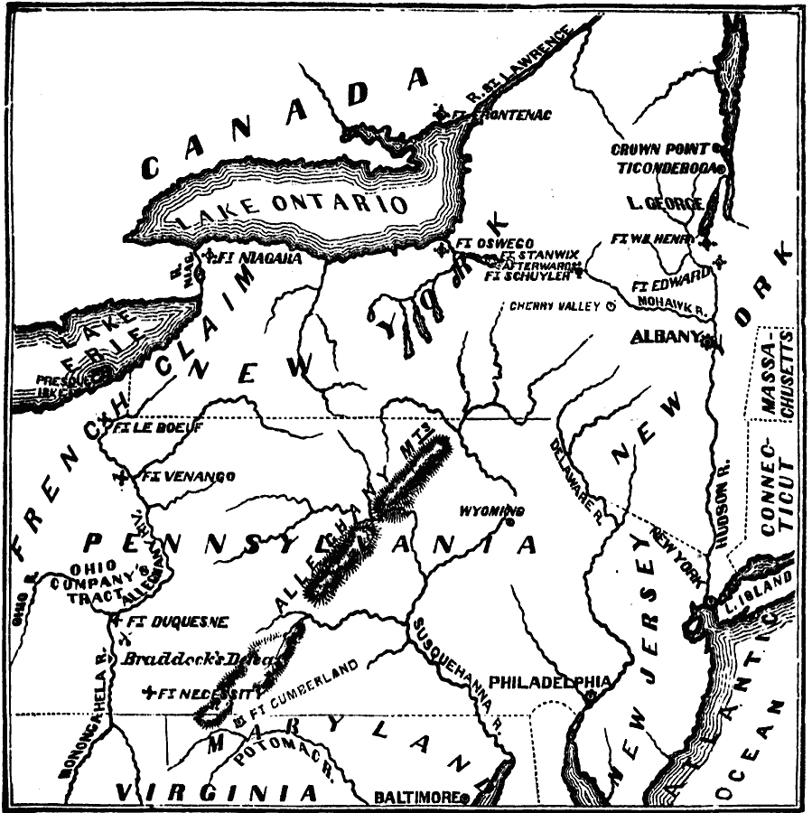
Description: A map of the eastern Great Lakes region to the Hudson River and Lake Champlain showing the chief scene of operations of the French-Indian War at the outbreak of the war in 1754–1755. The map shows the British and French forts and important battle sites in the region.
Place Names: Early America 1400-1800, Connecticut, �Maryland, �Massachusetts, �New Jersey, �New York, �Rhode Island, �Virginia, �French, �Native American
ISO Topic Categories: oceans,
location,
inlandWaters,
boundaries
Keywords: Chief Scene of Operations — French and Indian War, borders, �physical, �historical, �military, �country borders, historical event,
other military, oceans,
location,
inlandWaters,
boundaries, Unknown, 1754–1755
Source: David B. Scott, A School History of the United States, from the discovery of America to the year 1880. (New York, NY: American Book Company, 1884) 128
Map Credit: Courtesy the private collection of Roy Winkelman |
|