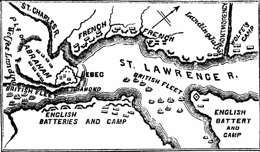
Description: A map of the area around Quebec showing important sites in the siege and capture of the city by the British General James Wolfe in 1759 during the French and Indian War (1754–1763). The map shows the location of Quebec, Wolfe's camp on the north bank of the St. Lawrence, the British batteries and camp (Monckton's camp) on the south bank, the French camp and fortifications, the position of the British fleet, and Wolfe's landing point below the Plains of Abraham, and the site of the battle leading to the capture of Quebec (12 September, 1759).
Place Names: Canada, Canada, �Quebe
ISO Topic Categories: oceans,
location,
inlandWaters,
boundaries
Keywords: Operations during the Capture of Quebec, borders, �physical, �historical, �military, �country borders, historical event,
other military, oceans,
location,
inlandWaters,
boundaries, Unknown, 1759
Source: David B. Scott, A School History of the United States, from the discovery of America to the year 1880. (New York, NY: American Book Company, 1884) 141
Map Credit: Courtesy the private collection of Roy Winkelman |
|