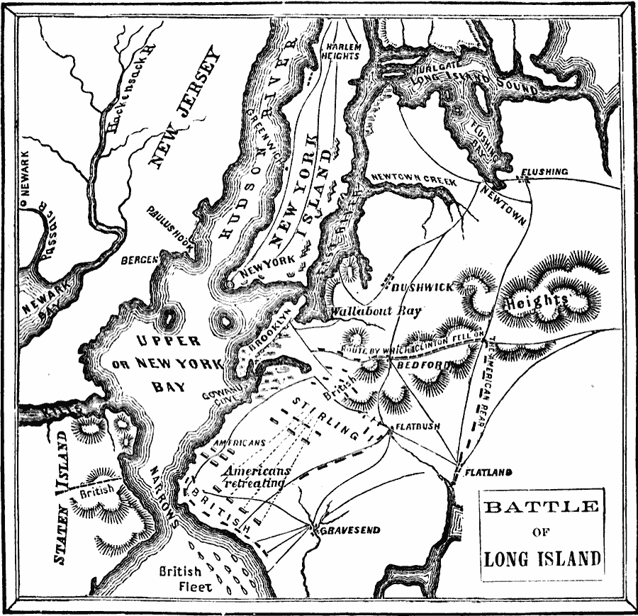
Description: A plan of the Battle of Long Island (August 27, 1776), also known as the Battle of Brooklyn, fought between the British army under General Howe and the Americans under George Washington during the American Revolutionary War. The map shows the position of the British Fleet in the Narrows and their landing site, the American position on the Guana Heights, the route of the British flanking maneuver to the American rear by Henry Clinton, and the line of retreat of the Americans to Brooklyn Heights.
Place Names: Early America 1400-1800, Bedford, �Brooklyn, �Long Island, �Massachusetts, �New Jersey, �New York,�Staten Island, �American Revolutio
ISO Topic Categories: oceans,
location,
inlandWaters,
boundaries
Keywords: Battle of Long Island, American Revolution, �borders, �physical, �historical, �military, kAmericanRevolution, kBattle, country borders, historical event,
American Revolution, oceans,
location,
inlandWaters,
boundaries, Unknown, 1775–1776
Source: David B. Scott, A School History of the United States, from the discovery of America to the year 1880. (New York, NY: American Book Company, 1884) 170
Map Credit: Courtesy the private collection of Roy Winkelman |
|