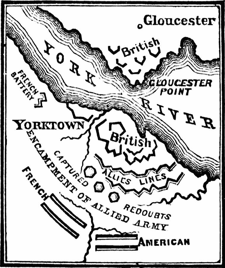
Description: A detail of Yorktown, Virginia during the siege of 1781 at the close of the American Revolutionary War. The map shows the British fortifications at Yorktown and across the York River at Gloucester, the allied lines, French battery, captured British redoubts, the encampment of the allied army, and the French and American lines.
Place Names: Early America 1400-1800, Glouchester, �New York, �Yorktown, �American Revolutio
ISO Topic Categories: oceans,
location,
inlandWaters
Keywords: Siege of Yorktown, physical, �historical, �military, �war, kAmericanRevolution, kBattle, country borders, historical event, oceans,
location,
inlandWaters, Unknown, 1781
Source: David B. Scott, A School History of the United States, from the discovery of America to the year 1880. (New York, NY: American Book Company, 1884) 216
Map Credit: Courtesy the private collection of Roy Winkelman |
|