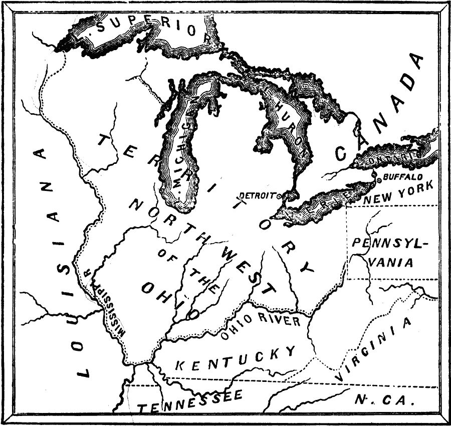
Description: A map of the Northwest Territory of the newly formed United States, established by the Congress of the Confederation of the United States in 1787. "The session of 1787 was distinguished by an act worthy of lasting remembrance. Virginia, Connecticut, and Massachusetts, by their original charters, had an indefinite western boundary, which became, by the treaty of Paris in 1763, the Mississippi River. Virginia ceded her claim to this vast region in 1784, and in this cession was soon followed by the other two states; and also by New York. In July, 1787, Congress passed the famous Ordinance for the government of this region north of the Ohio, under the name of the Territory of the Northwest." — Scott, 1884, p. 221.
Place Names: Early America 1400-1800, Kentucky, �Louisiana, �New York, �North Carolina, �Ohio, �Pennsylvania, �Tennessee, �Virgini
ISO Topic Categories: oceans,
location,
inlandWaters
Keywords: The Northwest Territory, physical, �historical, �military, �war, �country borders, historical event, oceans,
location,
inlandWaters, Unknown, 1787
Source: David B. Scott, A School History of the United States, from the discovery of America to the year 1880. (New York, NY: American Book Company, 1884) 222
Map Credit: Courtesy the private collection of Roy Winkelman |
|