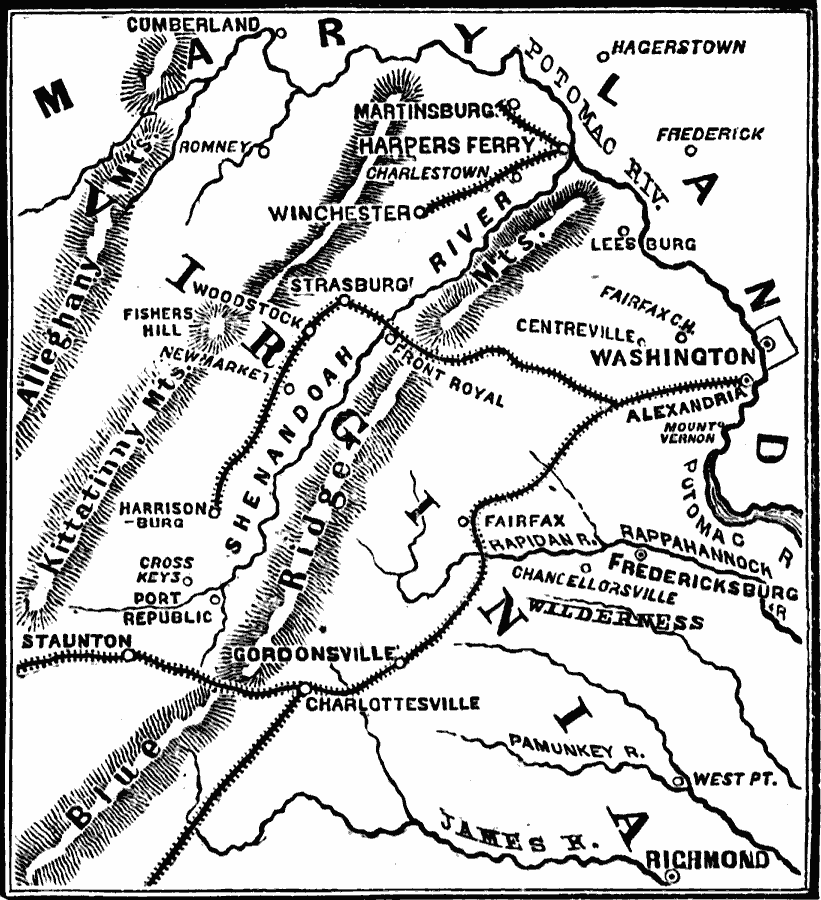
Description: A map of northern Virginia and the Shenandoah Valley area in 1862. The map shows the area from Harpers Ferry on the Potomac River to Staunton in the valley, the Alleghany, Kittatinny, and Blue Ridge mountains, Charlottesville, Richmond, Fredericksburg, and Washington, and the railroads in the area.
Place Names: Civil War, Alexandria, �Fairfax, �Fredericksburg, �Virginia,
ISO Topic Categories: oceans,
location,
inlandWaters
Keywords: North Virginia–Shenandoah Valley, physical, �historical, �military, �war, �country borders, historical event, oceans,
location,
inlandWaters, Unknown, 1862
Source: David B. Scott, A School History of the United States, from the discovery of America to the year 1880. (New York, NY: American Book Company, 1884) 345
Map Credit: Courtesy the private collection of Roy Winkelman |
|