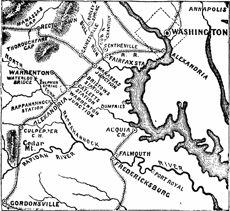
Description: A map of the area between Cedar Mountain, Virginia, and Washington showing the route of General Pope in his retreat to Washington. The map shows the cities and towns, railroads, terrain, and rivers in the area, and includes the important sites of Cedar Mountain (August 9), Manassas Junction (August 26), Centerville (August 28), Gainesville (August 29), Chantilly (September 1), and return to Washington.
Place Names: Civil War, Alexandria, �Fairfax, �Fredericksburg, �Virginia, �Washington D.C., �Williamsburg, �Yorktown,
ISO Topic Categories: oceans,
location,
inlandWaters
Keywords: Pope's Retreat to Washington, physical, �historical, �military, �war, �country borders, historical event, oceans,
location,
inlandWaters, Unknown, 1862
Source: David B. Scott, A School History of the United States, from the discovery of America to the year 1880. (New York, NY: American Book Company, 1884) 350
Map Credit: Courtesy the private collection of Roy Winkelman |
|