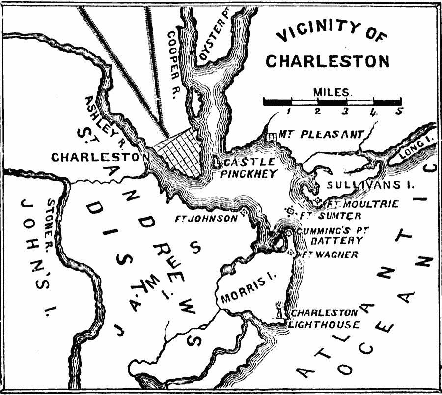
Description: The vicinity of Charleston, North Carolina in 1861, site of Fort Sumter and the opening battle of the American Civil War. The map shows the city of Charleston and railroads, the Union held Fort Sumter and light house at the mouth of the Charleston Harbor, Confederate held Fort Moultrie on Sullivan's Island on the northern approach to the harbor, and Confederate held Fort Johnson on James Island on the southern approach to the harbor.
Place Names: Civil War, Charleston, �Virginia,
ISO Topic Categories: oceans,
location,
inlandWaters
Keywords: Vicinity of Charleston, physical, �historical, �military, �war, �country borders, historical event, oceans,
location,
inlandWaters, Unknown, 1861
Source: David B. Scott, A School History of the United States, from the discovery of America to the year 1880. (New York, NY: American Book Company, 1884) 360
Map Credit: Courtesy the private collection of Roy Winkelman |
|