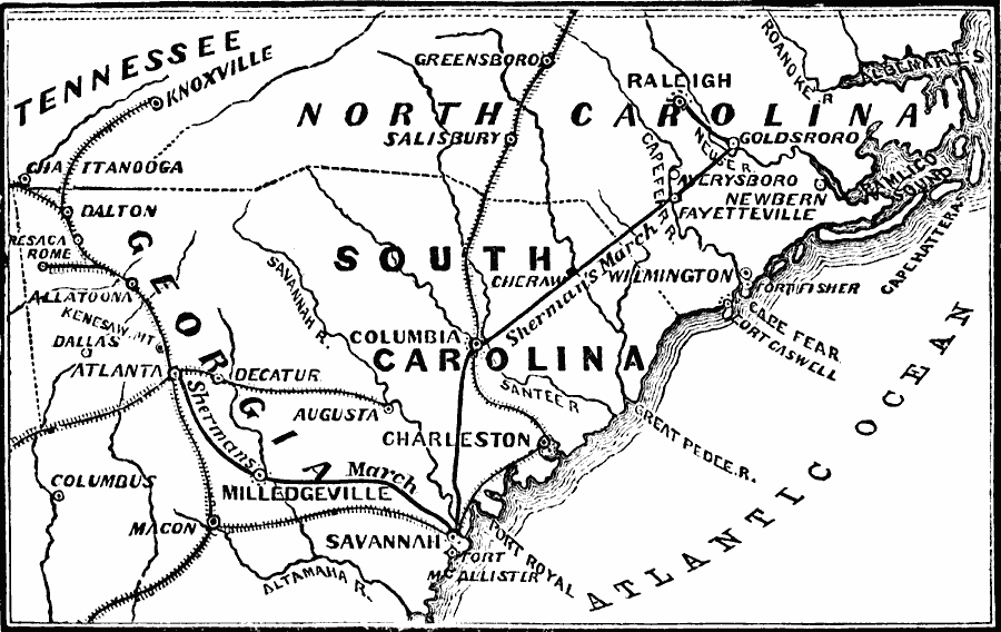
Description: A map of the parts of Georgia, South Carolina, and North Carolina, showing the area of General Sherman's march from Dalton, Georgia, Atlanta, and on to Savannah, South Carolina (May–December, 1864), and his northward march from Savannah to Columbia, Goldsboro, and Raleigh (February–April,1865) during the closing period of the American Civil War.
Place Names: Civil War, Atlanta, �Augusta, �Georgia, �North Carolina, �Savannah, �South Carolin
ISO Topic Categories: oceans,
location,
inlandWaters
Keywords: Sherman's March, physical, �historical, �military, �war, �country borders, historical event, oceans,
location,
inlandWaters, Unknown, 1864
Source: David B. Scott, A School History of the United States, from the discovery of America to the year 1880. (New York, NY: American Book Company, 1884) 371
Map Credit: Courtesy the private collection of Roy Winkelman |
|