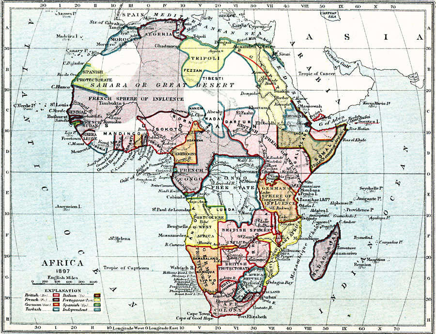
Description: Map of Africa in 1897 showing European colonial possessions and spheres of influence, and the independent territories at the time. The map is color–coded to show the areas controlled by the British, French, German, Turkish, Italian, Portuguese, and Spanish, and the independent countries and areas of Liberia, Morocco, Abyssinia, Dafur, Wadai, Kanem, Congo Free State, Orange State, and South African Free State.
Place Names: A Complete Map of Africa, Cape Colony, �British Bechuanaland, �South African Republic, �Angola, �Madagascar, �Congo, �Cameroon, �Sokoto, �Kong, �Ashanti, �Liberia, �Sierra Leone, �Senegal, �Timbuktu, �Morocco, �Algeria, �Tripoli, �Darfur, �Somali, �Egyp
ISO Topic Categories: inlandWaters,
location,
boundaries,
oceans
Keywords: Africa, physical, �political, �map of africa in 1897, british holdings, french colonies, german sphere of influence, turkish, italian, portuguese, spanish, independent, physical features, country borders, inlandWaters,
location,
boundaries,
oceans, Unknown, 1897
Source: Samuel Rawson Gardiner D.C.L., L.L.D., School Atlas of English History (London, England: Longmans, Green, and Co., 1914) 66
Map Credit: Courtesy the private collection of Roy Winkelman |
|