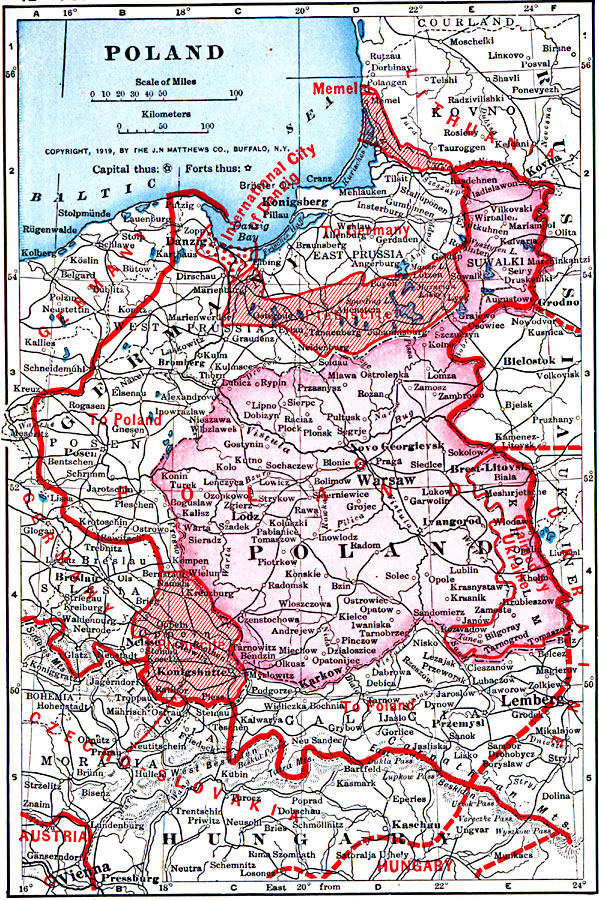
Description: A map from 1919 of Poland showing borders and boundary changes after World War I. The map shows principal cities and ports, railroads, rivers, and coastal features, and shows the territorial changes of the Ukrainian claims, the International city of Danzig, and territories to be determined by plebiscite.
Place Names: Poland, Germany, �Hungary, �Polan
ISO Topic Categories: boundaries,
inlandWaters,
location,
oceans
Keywords: Poland, physical, �political, �borders, �boundaries, �historical, �World War I, �WWI, physical features, country borders, WWI, boundaries,
inlandWaters,
location,
oceans, Unknown, 1914–1919
Source: Merton M. Wilner, A New Atlas of the New World Corrected According to the Peace Terms Together with a Graphic Story of the Great War 1914-1919 (New York, NY: The Christian Herald, 1919) 12
Map Credit: Courtesy the private collection of Roy Winkelman |
|