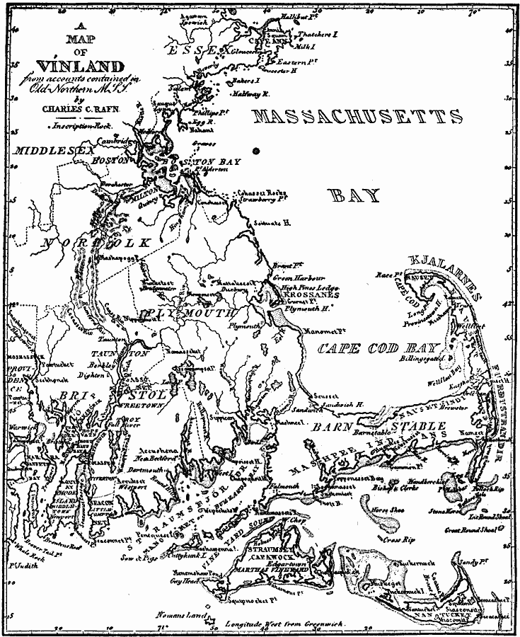
Description: A map from 1837 of the area around Boston, Massachusetts, proposed by Rafn to have been settled by early Norse explorers before the time of Columbus. The map shows the place names described in old Norse mythologies.
Place Names: Massachusetts, Cape Cod, �Boston, �Cambridge, �Nantucke
ISO Topic Categories: transportation,
location,
oceans,
inlandWaters
Keywords: Vinland, physical, �political, physical features, county borders, transportation,
location,
oceans,
inlandWaters, Unknown, 1837
Source: Justin Winsor, Narrative and Critical History of America Vol 1 (New York, NY: Houghton, Mifflin, and Company, 1889) 100
Map Credit: Courtesy the private collection of Roy Winkelman |
|