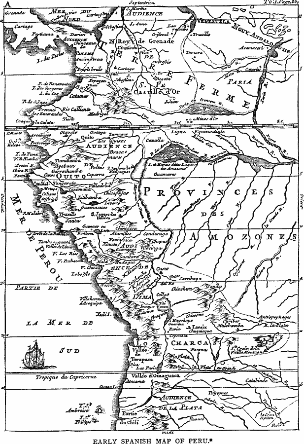
Description: A facsimile of an early Spanish map of Peru and northwest South America, from the Paris (1774) edition of Zarate. The map is in French, and the map coverage extends from Panama to the Paria River delta (Orinoco) of Venezuela in the north to the Tropic of Capricorn near the Desventuradas Islands of St. Ambroise (San Ambrosio) and St. Philippe (San Félix) in the south. The map shows the routes of the Spanish conquistadores, including Benal Casar in Columbia and Ecuador. Main Inca cities are shown.
Place Names: A Regional Map of South America, Lim
ISO Topic Categories: location,
oceans,
inlandWaters
Keywords: Early Spanish Map of Peru, physical, physical features, location,
oceans,
inlandWaters, Unknown, 1774
Source: Justin Winsor, Narrative and Critical History of America Vol 1 (New York, NY: Houghton, Mifflin, and Company, 1889) 211
Map Credit: Courtesy the private collection of Roy Winkelman |
|