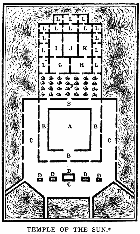
Description: A plan of the Inca Temple of the Sun in Cuzco, Peru. "The modern structure of the convent of Santo Domingo, built in 1534, is at A, which contains in its construction some remains of the walls of the older edifice. B is a cloister. C, an outer court. D, fountains for purification. E are streets leading to the great square of Cuzco. F, the garden where golden flowers were once placed; now used as a kitchen garden. G, the chapel dedicated to the moon. H, chapel dedicated to the rainbow. K, council hall of the grand pontiff and priests of the sun. L, the apartments of the priests and servants." — Winsor, 1889, p. 234.
Place Names: Peru, Cusc
ISO Topic Categories: location,
structure
Keywords: Temple of the Sun, physical, physical features, location,
structure, Unknown, 1534
Source: Justin Winsor, Narrative and Critical History of America Vol 1 (New York, NY: Houghton, Mifflin, and Company, 1889) 234
Map Credit: Courtesy the private collection of Roy Winkelman |
|