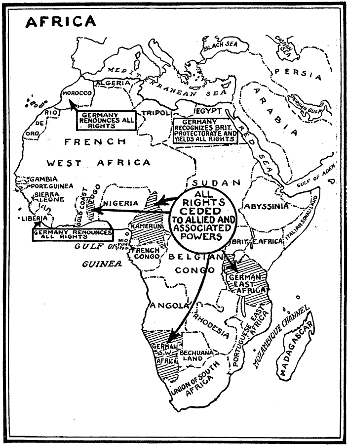
Description: A map of all German colonies and possessions in Africa ceded to the Allies in the Treaty of Versailles at the close of WWI.
Place Names: A Complete Map of Africa, French West Africa, �Sierra Leone, �Liberia, �Gambia, �Belgian Congo, �Angola, �South Africa, �Madagascar, �Sudan, �Egypt, �Algeria, �Tripoli, �Nigeria, German Southwest Africa, German East Africa, Kamerun, Togo, Morocco
ISO Topic Categories: boundaries,
transportation,
location,
oceans,
intelligenceMilitary
Keywords: Africa After WWI, political, �historical, kVersailles, country borders, WWI, boundaries,
transportation,
location,
oceans,
intelligenceMilitary, Unknown, 1919
Source: Willis J. Abbot, The United States in the Great War (New York, NY: Leslie-Judge Co., 1920) 310
Map Credit: Courtesy the private collection of Roy Winkelman |
|