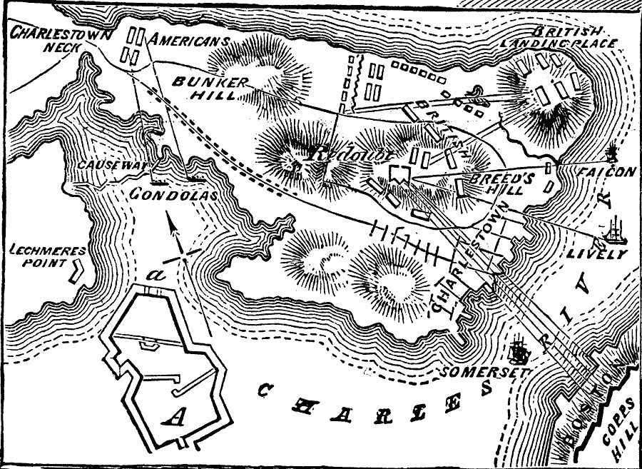
Description: A plan of the Battle of Bunker Hill (Breed's Hill) on the Charlestown peninsula in Boston Harbor (June 17, 1775), showing the American and British positions, the breastworks and redoubt built by the Americans, the artillery positions of the British on Copp's Hill, Morton's Hill, and naval positions of the British ship Falcon, Lively, and Somerset in the Charles River, and the gondolas near Charles Neck, with ranges given.
Place Names: Massachusetts,
ISO Topic Categories: location,
oceans,
transportation,
intelligenceMilitary,
structure
Keywords: Battle of Bunker Hill, historical, �transportation, �physical, kAmericanRevolution, physical features, roads, American Revolution, location,
oceans,
transportation,
intelligenceMilitary,
structure, Unknown, 1775
Source: Frank Gilbert, The World: Historical and Actual (Chicago, IL: National Library Association, 1892) 505
Map Credit: Courtesy the private collection of Roy Winkelman |
|