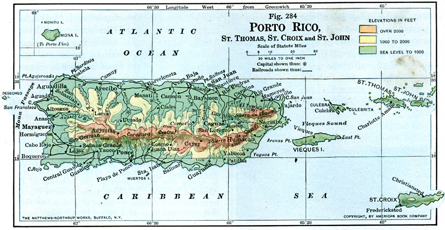
Description: A map from 1916 of Puerto Rico, St. Thomas, St. Croix, and St. John showing terrain and coastal features, rivers, principal cities, towns, and ports, and railroads. The map uses color–contouring to show land elevations from sea level to over 2000 feet. An inset map shows the island of Mona to the west of Puerto Rico.
Place Names: Puerto Rico, San Juan, �Guayama, �Ponce, �Aguadilla, �Mayaguez, �Carolina, �Fajardo, �Guanic
ISO Topic Categories: boundaries,
oceans,
location,
inlandWaters,
transportation
Keywords: Puerto Rico and Neighboring Islands, physical, �transportation, physical features, railroads, boundaries,
oceans,
location,
inlandWaters,
transportation, Unknown, 1916
Source: Albert Perry Brigham & Charles T. McFarlane, Essentials of Geography (New York, NY: American Book Company, 1916) 190
Map Credit: Courtesy the private collection of Roy Winkelman |
|