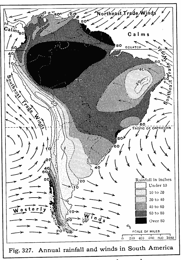
Description: A 1916 map of South America, showing annual rainfall and prevailing winds. This map shows the wind direction of the Northeast Trades, the Atlantic and Pacific Southeast Trades, and the Westerlies, and shows their effect on rainfall patterns. The map shows regions of mean annual rainfall ranging from under 10 inches to over 80 inches.
Place Names: A Complete Map of South America,
ISO Topic Categories: climatologyMeteorologyAtmosphere,
oceans,
location,
inlandWaters
Keywords: Rainfall and Winds in South America, physical, �meteorological, kClimate, physical features, rainfall,
winds, climatologyMeteorologyAtmosphere,
oceans,
location,
inlandWaters, Unknown, 1916
Source: Albert Perry Brigham & Charles T. McFarlane, Essentials of Geography (New York, NY: American Book Company, 1916) 222
Map Credit: Courtesy the private collection of Roy Winkelman |
|